
Both new and already battle-proven multiplayer gamemodes to the original tactical gameplay are waiting for you. Interactive destructible environments and the ability to direct-control any combat unit. Steam support: matchmaking, workshop, steamcloud. Redesigned graphics, models and special effects. Conceptual new interface and convenient control, new battlefields and new opportunities.
Features:
- Revival of the “Men of War/Soldiers” game series. This multiplayer tactical RTS absorbed the best of the original series, favourite of players all over the world.
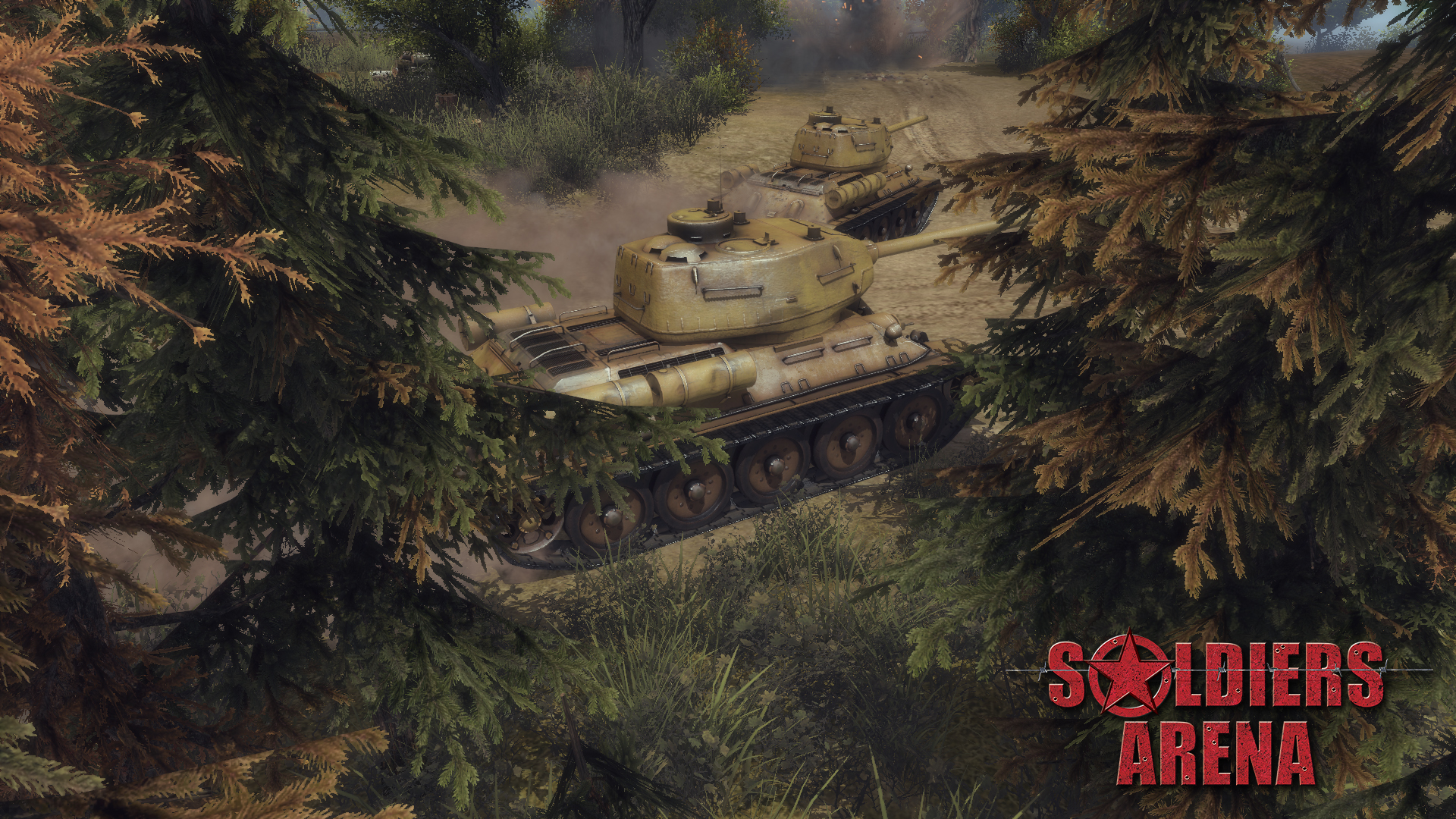
- Huge roster of units. Within a single game session, players will have access to a large number of unique units for every nation: tanks, vehicles, infantry and artillery of various types.
- The “Direct Control” mode. This mode provides the ability to play from the third person for any unit in the player’s army. The movement of the unit, firing the various guns, control of ammunition types, etc. all relying and directly controlled by player and thus the game conveys tactical action in it’s very essence.
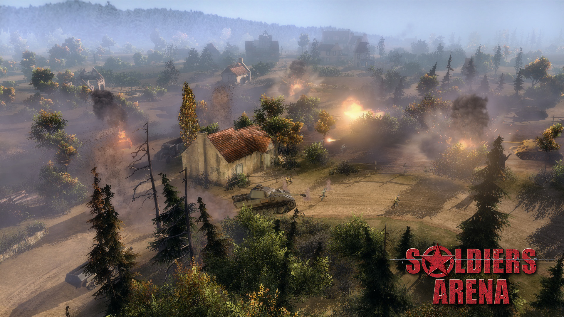
- Destructible interactive environments. During the battle almost any object of the game can be destroyed or set on fire. Furthermore, all objects, including craters from explosions, may be used as cover.
- Atmosphere and realism. Even in large-scale game battles, it is necessary to take into account factors such as the supply of fuel and ammunition of each single unit. The precense of inventories for each unit limits the number and size of transported objects. Guns’ accuracy and penetration decreases with distance. Tired soldiers reduce the movement speed during long crossings. The influence of these and many other factors makes possible to reproduce the battles of World War II with a adequate degree of realism, most involving the player into the atmosphere of heated battles of the past.
- Modular realistic damage system. Any vehicle, regardless of its type, is composed of a set of modules that can be broken or destroyed. Types of ammunition, characteristics of guns, shooting distance, angle of armor, armor plate thickness and the threshold of material fatigue are taken into account, when calculating the piercing capability and damage caused to each of the component. Additionally, there are calculations of the probability of detonation of ammunition, engine fires, damage to wheels or tracks (which leads to immobilization of combat units). If a component is not destroyed, it can be repaired.
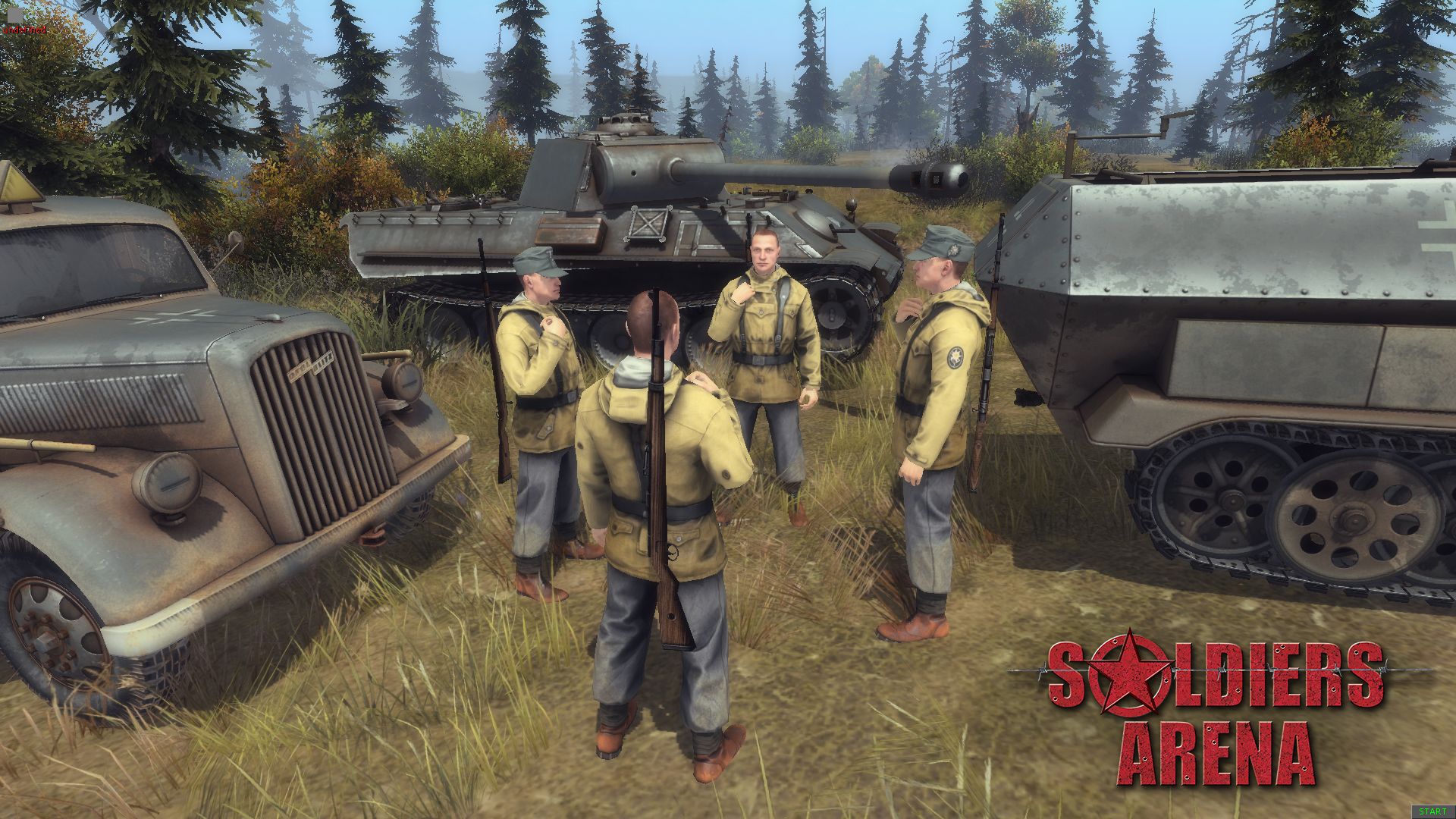
- Wide range of opportunities for infantry. Intelligence, combat, capture and repair of equipment, installation of anti-personnel and anti-tank obstacules of different types, construction of protective structures, health treatment, cover usage, ability to change through primary and secondary weapons, capture of buildings and territories.
- Great number of different types of weapons and ammunition. Pistols, submachine guns, machine guns, rifles and carbines, various types of grenades, dynamite, mines, knives and other items of equipment that are unique to each nation.
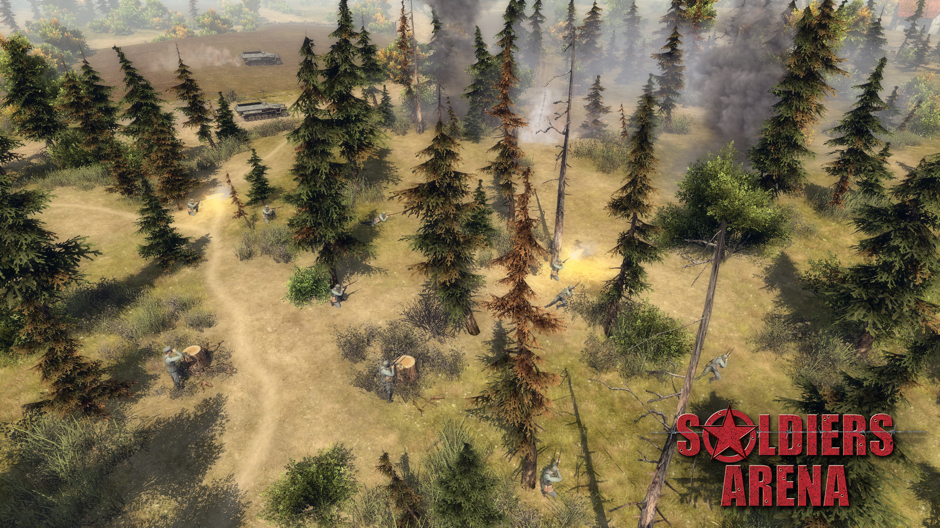
- Advanced Artificial Intelligence (Advanced AI). Infantry’s behaviour based on the feedback information from their own sensors (vision and acoustics), as well as allies’ signals. This allows the use of diversionary tactics, sending scouts into the enemy's rear, as well as to open the visibility with the help of special devices - observation towers, binoculars, telescopic tubes and sniper scopes. The morale of the infantry depends on the balance of forces on the battlefield - the soldiers may decide to advance or to withdraw from the fight.
- Conceptual new interface for convenient control.
- Enhanced game engine Gem2. Reworking of the game engine allows to provide a new level of graphics, the implementation of new and improvement already familiar to users game mechanics.
- OSX, Mac. Linux support.
- Full Steam support. Matchmaking, workshop, steamcloud, tradecards, achievments, steamstats, inventoryitems.
[img] https://puu.sh/xQLbi/336ec8ab2f.jpg [/img]
Hi, friends.
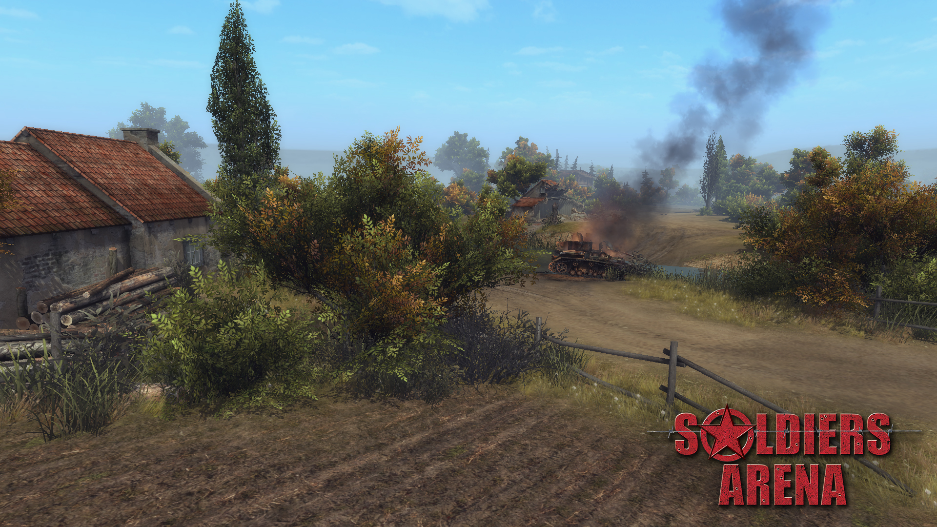
Today, we'll talk about working process on a new map that has already been mentioned here . Its working name is Polesie, so you can easily guess which region is taken as a basis for it. We wanted to create another village map, which could be used in the future for cooperative missions about the first months of combat operations in Ukraine during WW2. But stopping at a particular village would mean - putting yourself in a tight frame. First of all, this is a map for a team multiplayer game, which means that it should give the same opportunities for both sides. In life, this happens rarely.
[img] https://puu.sh/xQLhQ/06beabbbfe.jpg [/img]
An additional argument in favour of the village map was that some of the resources and models were already completed, so we would not have to make it from scratch. At this stage, this argument can not be ignored, because there are still a decent number of models that are waiting for a replacement in the game. Now we sometimes use old maps like Depo or Bazerville during the tests to slightly change the process and simplify the bugs search, but we can’t fully use them in Soldiers: Arena. Lots of work need to be done before that. Perhaps even more than with creating new ones. The map should not only be atmospheric and beautiful, but still meet the standards that dictate the new gameplay. We have different commanders in the game, so there must be zones on the map for the use of each unit: open areas for tank battles, areas with dense buildings for infantry fighting, bottlenecks for mining and using engineers, etc. Fighting for territory requires the presence of places of increased interest, where you can get a serious advantage if you gain a foothold. In addition, the height map should be easily readable so as not to cause irritation when player’s shell hits an inconspicuous elevation. And everything should be equally balanced for both sides of the conflict. Once we decided the region, we began to discuss its plan. This is how the rough draft version of the map looks. It will be corrected and refined in the process of work, that’s for sure.
[img] https://puu.sh/xQLdC/2f8b1ac09a.png [/img]
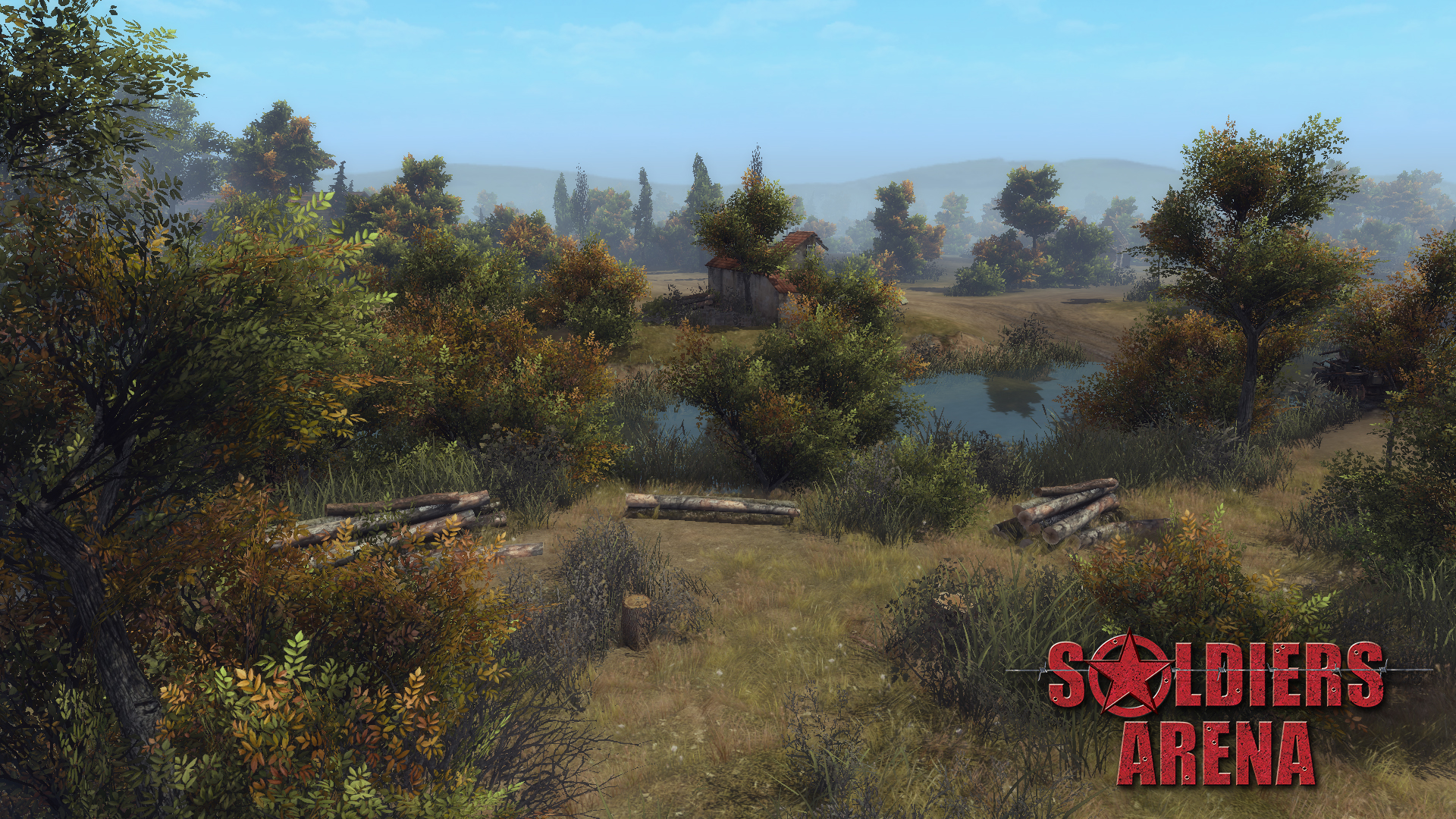
A large village in the center of the map, as the subject of the main dispute. Surrounded by fields and wide forest belts, where tanks and artillery can move freely. On the right side you can see the mill and miller's house (with the possibility of strengthening it), which are located on a raised platform. This is the main point of interest on this flank. Infantry can climb to the hill without problems, but the vehicles can only do so through narrow entrances, so that the player who is fortified on this island gets a good advantage in the defense. At the top and bottom of the map you can see abandoned farmsteads (forts on the map), which, like the mill, are on a small hill and have a clearly marked entrance. These locations are particularly interesting for artillery, since the entrances to them can easily be blocked by anti-tank hedgehogs or mined. However, this is not a secret for your enemy so he can shoot you with howitzers, send saboteurs, or simply surround. And there is not much place for maneuver, so artillery will start to unmask faster and faster because of the noise mechanics. The left part of the map is a swamped forest, in which tanks and infantry move slower, and the battle will go over the parts of solid ground. Only on them the player can dig trenches, install mines and barrages, so you always have to choose: advance slowly with the risk of getting into an ambush, or with the usual speed and explode on the minefield. On the left flank of the map we want to realize interesting opportunities for infantry gameplay.
Once we have decided the region and the initial layout of the map, it is time to look for references to convey the atmosphere of the area and show it believable. After all, buildings and entourage are seriously different from region to region. Someone even had to sacrifice a piece of vacation to visit the outdoor Museum of Folk Architecture and Life of Ukraine , look at the huts with his own eyes and collect more information. Here are a couple of examples of implementing these references in the game.
[img] https://puu.sh/xQLa9/3abd9fdb27.jpg [/img]
[img] https://puu.sh/xQL91/81a2c1005a.jpg [/img]
[img] https://puu.sh/xQL8w/14a3e4af4c.jpg [/img]
[img] https://puu.sh/xQLaf/618a486efe.jpg [/img]
So that’s all for now. Maybe you have favorite maps from past games that you would like to see in Soldiers: Arena? Also, feel free to write your wishes about zoning of Polesie, while work on it is still under way. And as usual we wish you the best!
Minimum Setup
- OS: Ubuntu 12.04
- Processor: 2 GHz Intel Dual CoreMemory: 4 GB RAM
- Memory: 4 GB RAM
- Graphics: 3D Hardware Accelerator Card Required - OpenGL 3.0 compatibleNetwork: Broadband Internet connection
- Storage: 5 GB available space
Recommended Setup
- OS: Ubuntu 15.04
- Processor: Intel Core i5-2.5GHzMemory: 8 GB RAM
- Graphics: NVIDIA GeForce GTX 560 or AMD Radeon HD 7750 with 1 GB VRAM or betterNetwork: Broadband Internet connection
- Storage: 5 GB available space
[ 6376 ]
[ 5865 ]
[ 751 ]
[ 2194 ]

Time left:
356103 days, 11 hours, 18 minutes

Time left:
356103 days, 11 hours, 18 minutes
Time left:
7 days, 19 hours, 18 minutes

Time left:
35 days, 19 hours, 18 minutes

Time left:
38 days, 19 hours, 18 minutes

Time left:
39 days, 19 hours, 18 minutes
Time left:
13 days, 5 hours, 18 minutes
Time left:
0 days, 13 hours, 18 minutes
Time left:
1 days, 13 hours, 18 minutes
Time left:
8 days, 13 hours, 18 minutes
Time left:
14 days, 13 hours, 18 minutes
Time left:
15 days, 13 hours, 18 minutes
Time left:
20 days, 13 hours, 18 minutes
Time left:
26 days, 13 hours, 18 minutes
Time left:
2 days, 23 hours, 18 minutes
Time left:
10 days, 19 hours, 19 minutes

Time left:
12 days, 18 hours, 19 minutes
Time left:
18 days, 1 hours, 29 minutes


