


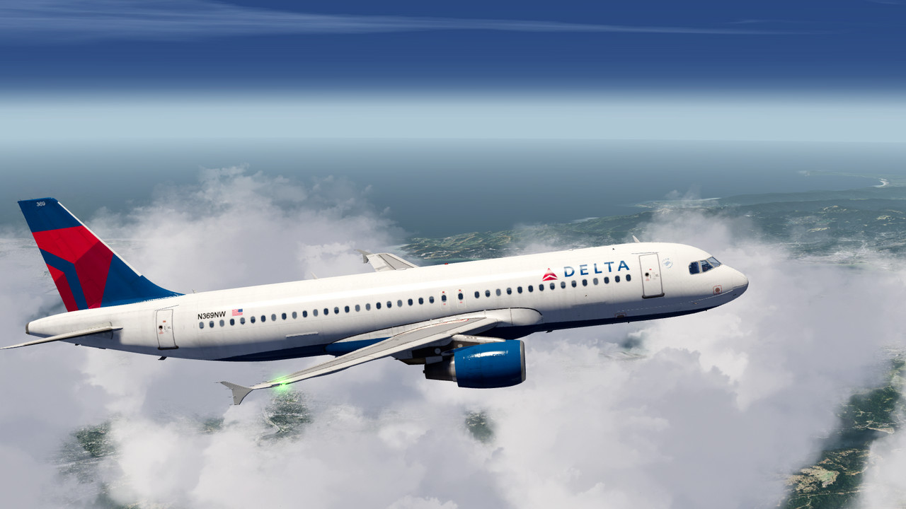

Aerofly FS 2 is a next generation flight simulator open for add-ons and sets a high value on realistic flight physics, highly detailed aircraft and a stunning, photo realistic scenery. World wide coverage of elevation data and aerial images is included with Aerofly FS 2. At the same time, Aerofly FS 2 features an intuitive user interface and requires virtually no training time.
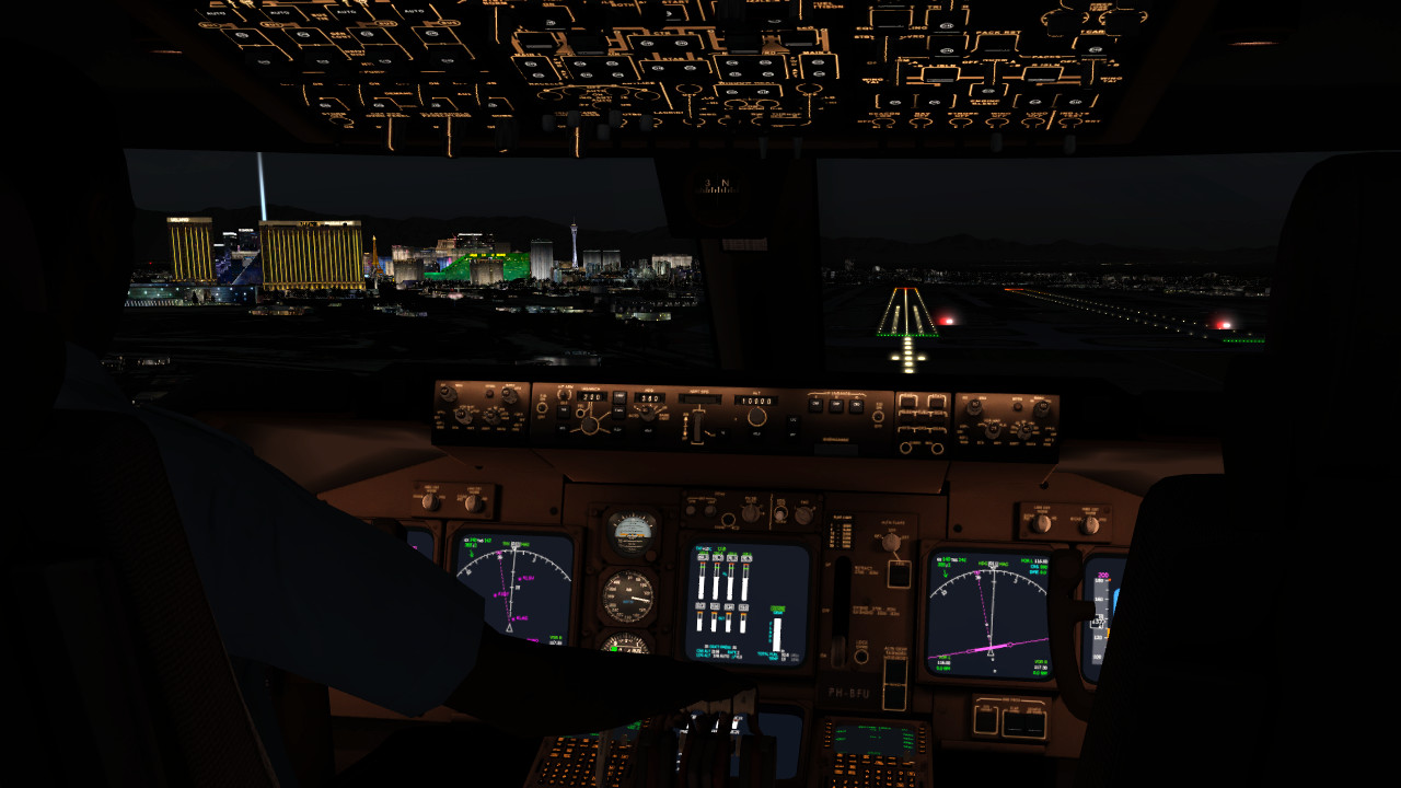
Take your seat in the cockpit and enjoy flying over the famous Golden Gate Bridge or visit Alcatraz Island. Learn the basics of flying at our flight school or jump right into the captain's seat and land the majestic 747 at one of the busiest airports of the world.
FEATURES
- 16 aircraft included:
- F-18, Learjet 45, C172, Baron 58
- ASG 29 glider, Pitts S-2B biplane
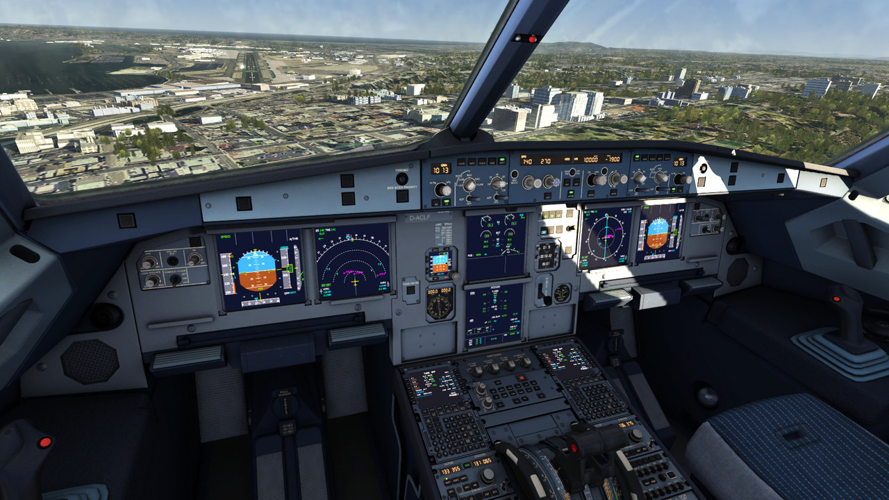
- Airbus A320
- B737-500, B747-400
- King Air C90 GTx, Aermacchi MB-339
- Corsair F4U, Extra 330
- Swift S1 glider, P-38 Lightning
- Sopwith Camel - Highly detailed and interactive 3D cockpits
- Adjustable cockpit lighting at night time
- Realistic flight physics
- Interactive Flight school for learning the basics of flying
- High resolution aerial images and over 150 airports for the South West of the United States
- World wide elevation and aerial images
- Display terrain features like mountains, lakes and cities for easy VFR navigation
- Route editor for easy flight planning
- Adjustable time of day
- Adjustable wind, clouds, visibility, thermal activity and turbulence
- Replay system
- Different view modes
- Support for multiple joysticks, throttle units, rudder pedals and more
- TrackIR support
- Full Oculus Rift VR support
- HTC Vive VR support
- Support for Saitek Multi Panel, Radio Panel, Switch Panel and Saitek TPM
🕹️ Partial Controller Support
- Aerofly FS 2 Flight Simulator Linux Binaries [9.87 M]
- Aerofly FS 2 - High resolution aerial images for USA South West (486110) Depot [57.55 G]
- Aerofly FS 2 - Switzerland (500620) Depot [14.83 G]
- Aerofly FS 2 - Northeastern USA (570310) Depot [7.11 G]
- Aerofly FS 2 - USA Utah (611210) Depot [15.49 G]
- Aerofly FS 2 - ORBX - Chicago Meigs Field (643731) Depot [568.63 M]
- Aerofly FS 2 - Aircraft - Q400 (684610) Depot [66.07 M]
- Aerofly FS 2 - USA Colorado (742410) Depot [17.18 G]
- Aerofly FS 2 - Orbx - Monterey Regional Airport (771830) Depot [263.24 M]
- Aerofly FS 2 - Orbx - Eagle County Colorado (794140) Depot [2.06 G]
- Aerofly FS 2 - Aerosoft - Germany Helgoland (820940) Depot [767.44 M]
- Aerofly FS 2 - USA South Florida (898700) Depot [3.16 G]
- Aerofly FS 2 - Orbx - Netherlands TrueEarth (932760) Depot [14.45 G]
- Aerofly FS 2 - Aerosoft - Lukla (1101750) Depot [7.11 G]
- Aerofly FS 2 - Just Flight - Duchess (1121620) Depot [337.11 M]
- Aerofly FS 2 - Just Flight - Arrow (1121621) Depot [390.67 M]
- Aerofly FS 2 - Just Flight - C152 (1121622) Depot [295.49 M]
- Aerofly FS 2 - Just Flight - Tomahawk (1214170) Depot [184.14 M]
- Aerofly FS 2 - High Resolution Texture Pack for Southwestern USA
- Aerofly FS 2 - Switzerland
- Aerofly FS 2 - Northeastern USA
- Aerofly FS 2 - USA Utah
- Aerofly FS 2 - Orbx - Innsbruck Airport
- Aerofly FS 2 - Orbx - Chicago Meigs Field
- Aerofly FS 2 - Aircraft - Q400
- Aerofly FS 2 - USA Colorado
- Aerofly FS 2 - Orbx - Monterey Regional Airport
- Aerofly FS 2 - Orbx - Eagle County Colorado
- Aerofly FS 2 - Orbx - Palm Springs International Airport
- Aerofly FS 2 - France VFR - Paris-Ile-de-France
- Aerofly FS 2 - Aerosoft - Germany Helgoland
- Aerofly FS 2 - USA South Florida
- Aerofly FS 2 - Orbx - Netherlands TrueEarth
- Aerofly FS 2 - Aerosoft - Lukla
- Aerofly FS 2 - Just Flight - Duchess
- Aerofly FS 2 - Just Flight - Arrow
- Aerofly FS 2 - Just Flight - C152
- Aerofly FS 2 - Just Flight - Tomahawk
- Aerofly FS 2 - Just Flight - Falke SF25
- Aerofly FS 2 - Just Flight - Hawk
- Aerofly FS 2 - France VFR - Paris-Ile-de-France Airport Pack
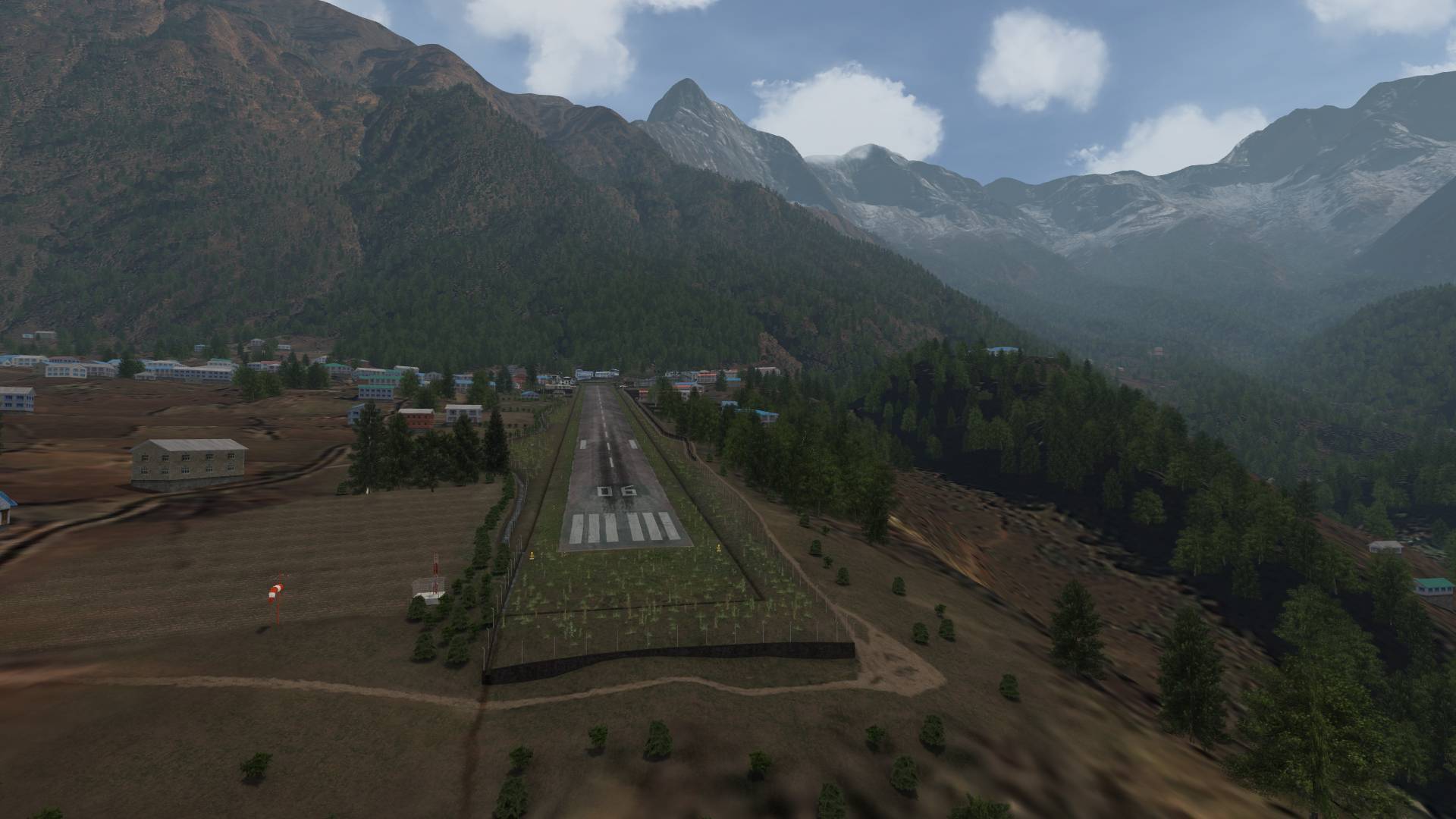
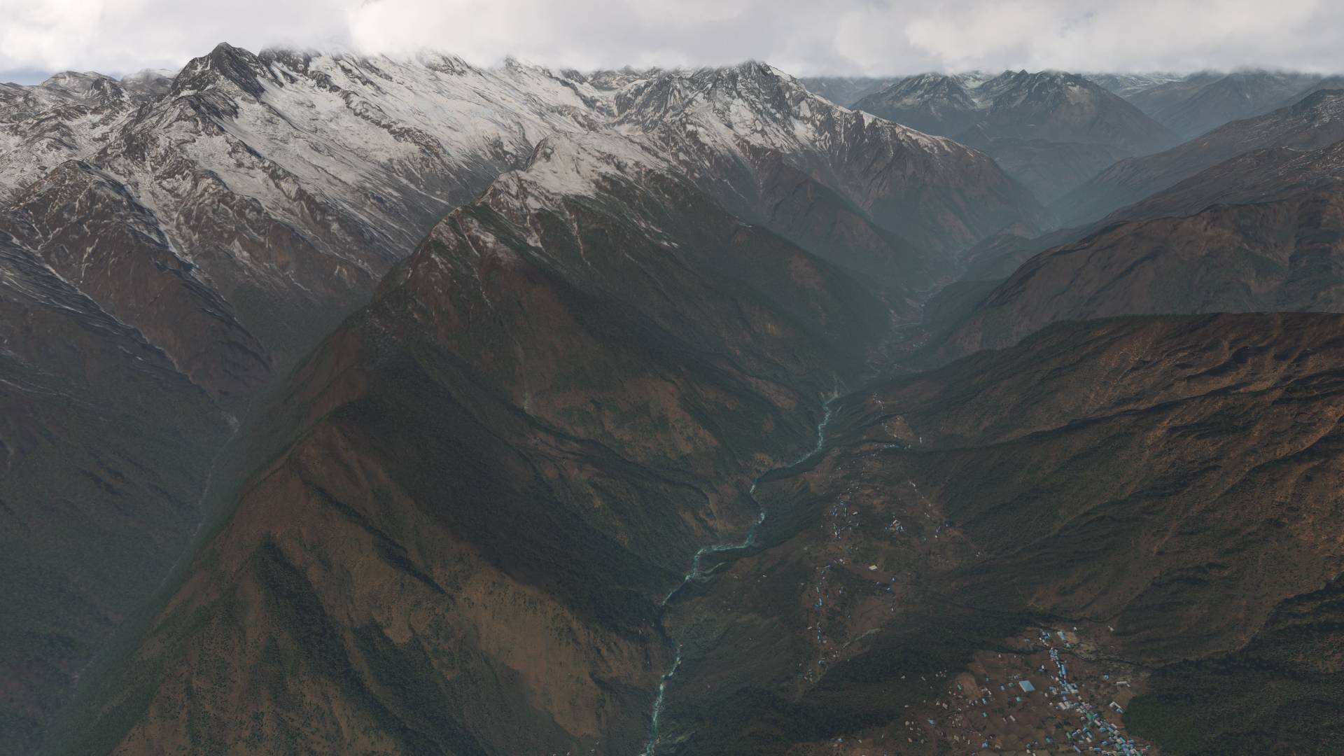
For those of you who aren't aware, Aerosoft has released another beautiful scenery package for Aerofly FS2. Lukla - Mount Everest - Extreme has just been released and it's packed with goodness.
Gateway to Mount Everest and World's Most Dangerous Airport are certainly the most commonly used attributes for Lukla an airport that seems out of this world.
There are airports that are higher (see Tingri included in this add-on). There may be airports that have a shorter runway or an even worse upwards slope of the runway. Others have a mountain wall at the end of its runway. What makes Lukla standing out is its combination of all those factors in one single airport!
Not enough thrill for you? Count in weather as a factor. No navigational aids. Limited documentation of approach and takeoff routes. An uncontrolled airpace with fixed wing aircraft and helicopters.
Bring your engines (and brakes!) to their limits by heading up the valley to Syangboche, a bumpy airstrip located even higher and surrounded by rocks high above a steep valley. Or try to find a helicopter that can reach helipads at these altitudes or even land at the Mount Everest basecamp, located right next to sharp glacier pinnacles between rock outcrops.
This package is a successor to "Lukla X Mount Everest", one of our most popular sceneries of the past decade that has won many awards among them the Simflight Award. This new version is a completely new development setting the bar even higher, coming with much more content than the previous version.
Features:
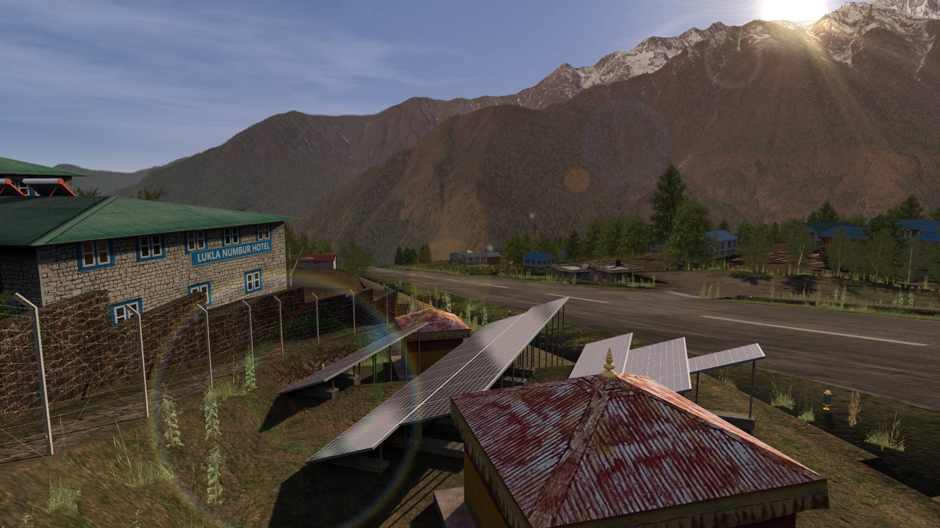
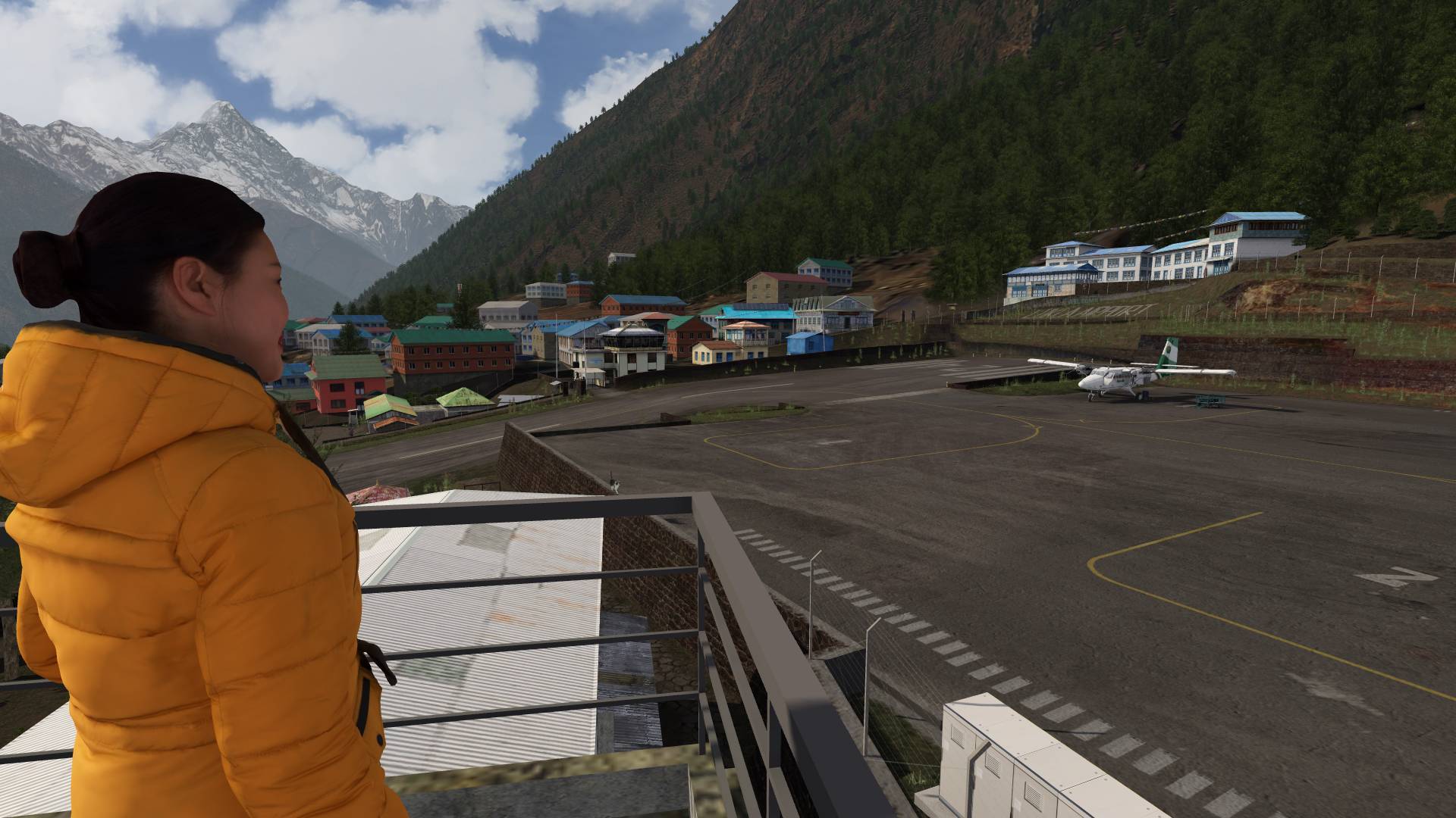
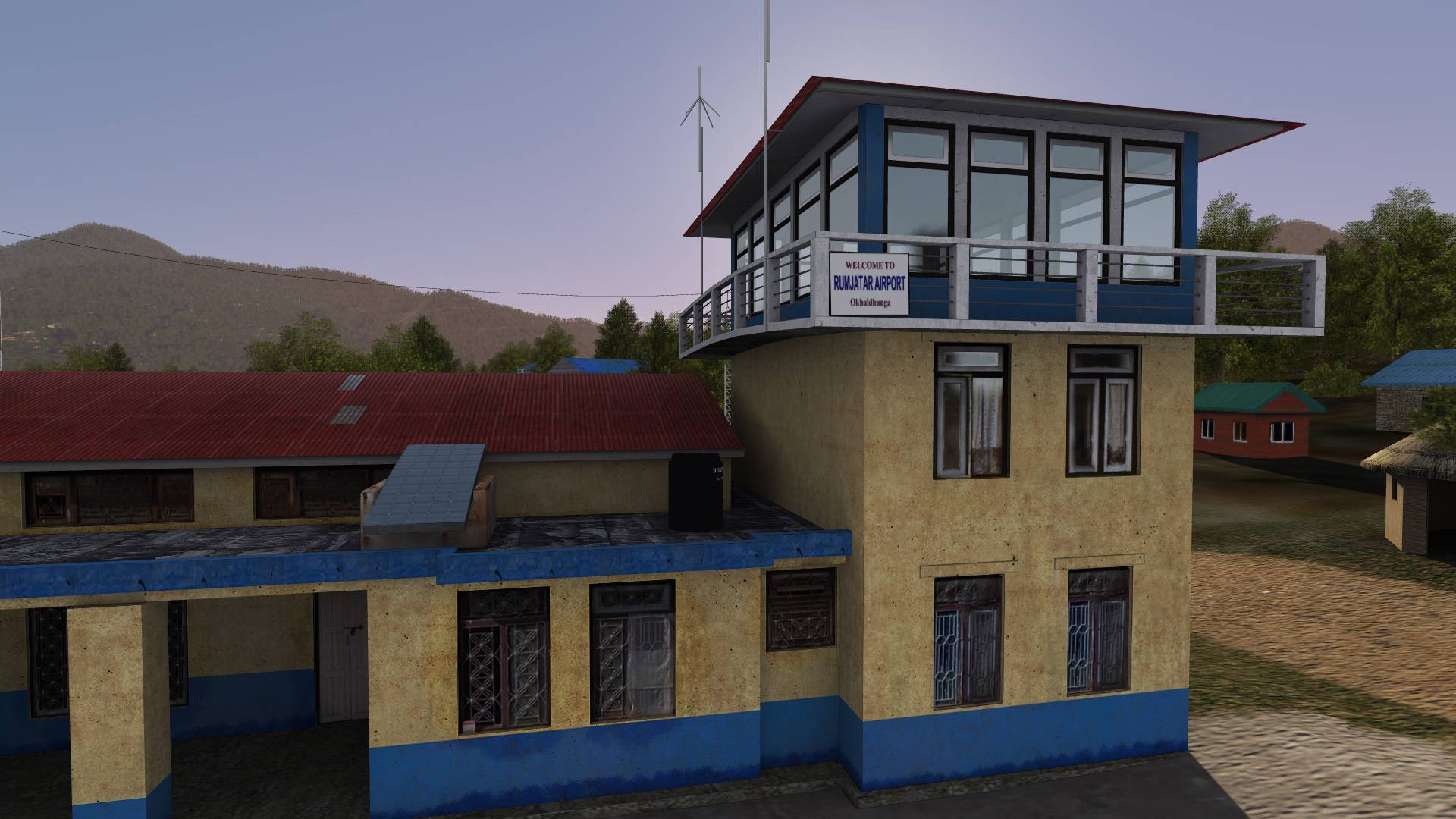
5 highly detailed airports with all buildings and clutter objects like vegetation, people, animals, vehicles and more:
VNLK Lukla
VNSB Syangboche
VNPL Phaplu
VNKL Kangel Danda
VNRT Rumjatar
7 generic airports with details like tower positions, ground layout and thrilling hand-edited terrain:
VNKD Man Maya Khanidanda
VNBJ Bhojpur
VNTR Tumlingtar
VNRC Ramechhap
VNJI Jiri
VNTJ Taplejung Suketar
VNLD Lamidanda
12 helipads, most of them at very high altitudes
A whopping coverage area of 200x200 kilometres
Detailed hand-edited mesh terrain
More than 366 thousand cultivation buildings
More than 60 million (!) individually placed trees in their respective vegetation areas (e.g. shrubs in the alpine areas, tropical trees in the valley rain forests)
A hand-edited and geo-referenced combination of satellite imagery with higher resolutions around the core areas
Modelled points of interest like hanging bridges, stupas, etc.
Detailed mesh with rock and glacier outcrops around Mt. Everest Basecamp making helicopter landings there as challenging as they really are
Extensive manual with custom made maps and airport charts
Free bonus: Semi-fictional to-be-build large Tingri Airport north of Mount Everest
CON: Not a single airport with a flat runway
Minimum Setup
- OS: 64 Bit Linux
- Processor: Intel Quad core CPU 3.0 GHzMemory: 8 GB RAM
- Memory: 8 GB RAM
- Graphics: OpenGL 4.0 compatible 3D graphic card with at least 2 GB of RAM
- Storage: 40 GB available space

[ 6370 ]
[ 5870 ]
[ 1991 ]
[ 1943 ]
[ 986 ]

Time left:
356099 days, 22 hours, 49 minutes

Time left:
356099 days, 22 hours, 49 minutes

Time left:
4 days, 6 hours, 49 minutes

Time left:
32 days, 6 hours, 49 minutes

Time left:
35 days, 6 hours, 49 minutes

Time left:
36 days, 6 hours, 49 minutes

Time left:
9 days, 16 hours, 49 minutes
Time left:
5 days, 0 hours, 49 minutes
Time left:
11 days, 0 hours, 49 minutes
Time left:
12 days, 0 hours, 49 minutes
Time left:
17 days, 0 hours, 49 minutes
Time left:
19 days, 0 hours, 49 minutes
Time left:
23 days, 0 hours, 49 minutes
Time left:
2 days, 14 hours, 4 minutes

Time left:
7 days, 6 hours, 50 minutes

Time left:
9 days, 5 hours, 50 minutes
Time left:
14 days, 13 hours, 0 minutes


